FiRe Speaker Q & A: Patrick Hogan
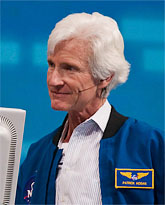 We interviewed SNS member and FiRe 2013 speaker Patrick Hogan, Project Director of NASA World Wind, about his recent work on the NASA virtual globe project and open-source initiative. The following is an edited compilation of his replies. Special thanks to Patrick for taking time out of his busy schedule for this interview.
On the World Wind Project, Patrick Hogan’s involvement, and how SNS fits in:
World Wind is NASA virtual globe technology – an Earth browser – provided to the world community as open source. As far as my role, I see myself as a facilitator, acquiring the resources and supporting the talent needed for World Wind.
World Wind has taken up the greater part of my life for the past 10-plus years. It began as a kind of “skunk works” (minimal bureaucracy) to build a virtual globe. In 2002, the idea was to make NASA data more useful by delivering Earth imagery and elevation data in its full context. This began as Digital Earth, out of NASA’s Goddard Space Flight Center.
We further purposed this technology to facilitate others in providing value-added without having to continually recreate the wheel of an Earth browser. Fortunately, we have one of the best software architects in the business, Tom Gaskins. Then in 2006, when we were asked by the Department of Energy to re-engineer this Windows app for cross-platform use, Tom engaged the talents of David Collins as the lead developer. This is World Wind Java today and now World Wind iOS.
World Wind, Virtual Earth, Google Earth, and ESRI ArcView are similar technologies in that they are all virtual globes. Except for World Wind, the user is greatly limited by what they can do with these applications. If you want to do line-of-sight or fuel-consumption calculations, you need access to the terrain data. Google doesn’t allow this access or the ability to work with data dynamically. For the most part, you can only do what is accessible via KML. This greatly limits the dynamic interaction with the data. World Wind, as open source, allows users to decide what they can do with the data in that virtual globe context.
You ask how SNS became involved. I heard one of the annual BBC’s Brian Day interviews with Mark Anderson on what the future of technology and the economy looks like. This was in 2008, for 2009. It was fascinating. I thought Mark might want to know more about this technology. As it turns out, the idea for an Earth browser was a “twinkle in the eye” of Mark a decade earlier.
On the World Wind “Europa Challenge”:
Despite World Wind’s extensive presence within the US Department of Defense community and NATO, we felt this technology could also better service other communities. You don’t have to be a rocket scientist to recognize the high degree of duplication for spatial data management tools throughout city, state, and national communities. Given that and discussions with the World Wind user community in Europe, it just seemed like the time was right for some public architecture that would help advance this idea for challenging the academic and business communities for solutions they could collectively share and independently advance.
The City of Springfield, Oregon, had already given life to this idea by providing, as open source, the city infrastructure management tool it was building with World Wind. Springfield is demonstrating leadership for what the president and Congress established in 1999 as the National Spatial Data Infrastructure (NSDI; Executive Order 12906). Then in 2005, the Federal Geographic Data Committee (FGDC) took responsibility for establishing NSDI “policies, criteria, standards, and people necessary to promote geospatial data sharing throughout all levels of government, the private and non-profit sectors, and academia.” To make all this work, the Open Geospatial Consortium (OGC) provides the open data standards, Web Mapping Services (WMS) and World Wind provides the open visualization technology for seeing that data.
Now, if you want to flag the future, you want Mark’s attention. So we invited him to help us brainstorm ideas for what we now call the “Europa Challenge.” It’s a small beginning for a big idea. This is the first year for what will be an annual event challenging the European academic and business communities for solutions that prevent the spatial data wheel from having to be continually recreated.
On World Wind Developments:
(Ed. Note: In 2009, Patrick wrote a Special Letter for the SNS Global Report, titled “Earth II Reborn: NASA’s World Wind.” Premium-level SNS members can access this archived Report on the www.stratnews.com website. This reply addresses the progress made since that Special Letter.)
The SNS Special Letter “Earth II Reborn: NASA’s World Wind” was a tremendous honor to be able to write for and with Strategic News Service! The things we believe in and work hardest for never progress fast enough, ideally at the speed of enlightenment. But during the interim, we’ve grown in sophistication and utilization. And now mobile devices have returned us to the pre-Java platform wars of yore. So we have to account for that.
Though World Wind’s involvement with the World Bank’s Probabilistic Risk Assessment program and Planetary Skin efforts continue, they have not sparked a global “mind meld” for spatial data. Today our hopes are in the Europa Challenge to provide the impetus for accelerating solutions.
Unfortunately, we are seeing States and Federal agencies moving in a direction opposite to the National Spatial Data Infrastructure Executive Order. California has just made its “public domain” data available through what looks like proprietary mechanisms. This will greatly hinder the development of solutions with that data. Work by the National Research Labs, Oak Ridge and Livermore, seem to have backed away from earlier stated goals of facilitating the climate research community’s data analysis and exchange thereof. So we are not yet embarking on a “bold new adventure” to generate solutions for common needs, much [less] common threats. We would welcome dialog and ideas from the SNS community for “where to go from here.”
On the Future – Concerns and Hopes:
My concerns for the future are expressed in facilitating better solutions for today. How can we maximize information access and the quality of information? All of our children, whether ours or theirs – and by extension, the entire K-through-gray community of the world – need quality information delivered in context. Our mission is that World Wind might help.
One of the crucial aspects to our ability to survive and thrive on this planet is being able to share information, resources, and expertise. A project that is using WorldWind to do that is Collaborate.org. They’ve pulled together a tremendous amount of geospatial data into a worldwide collaborative infrastructure that helps people visualize and share data, find other people of similar interests and passions, and collaborate to make a big impact on the world. Only through working together and sharing resources will we be able to address the challenges we face now and into the future.
We want to free up users to do whatever it is they need to. Additionally, we want them to have continual access to their solutions so they can evolve those solutions to better address their changing needs.
Hope is a wonderful word, and it can come from more people having better access to information. Being one of the most recent species to develop on this planet, we demonstrate great hubris in how we use this planet’s resources and one another. This is very dangerous. The more we free up access to information, and the tools for analyses to see ourselves in a global context, the more intelligent we will become as a community. This would seem a good thing, if we are interested in survival as well as happiness.